November 2022.
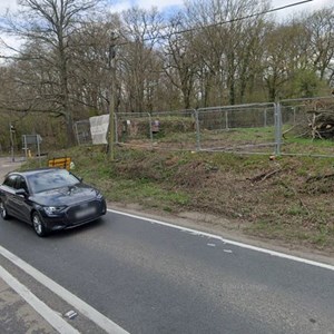
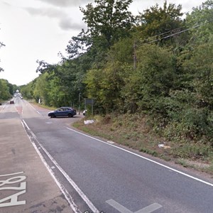
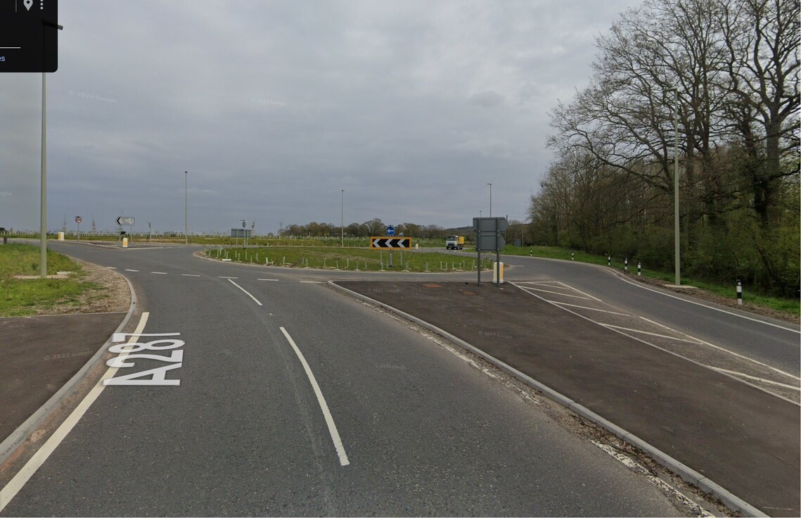
In October 2022, Vistry Group announced that the new roundabout at the junction of Redfields Lane and the A287 near Church Crookham was likely to open in late October 2022.
Temporary traffic lights were in place while the surfacing works were completed then after approval from Hampshire Highways the roundabout was finally opened to traffic in November 2022.
Redfield Lane Roundabout Works
Update Oct 2021
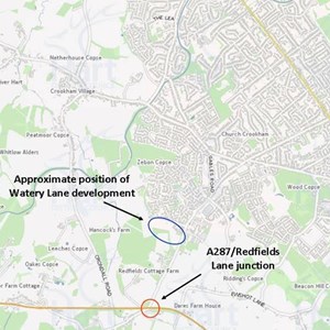
As part of the development proposals, Martin Grand Homes undertook to build a roundabout on the junction of Redfields Lane and the A287, south of the development - see map (inset). Some S106 funds had been reserved for this junction improvement from the original Zebon Copse development (also by Martin Grant) but the scheme had not progressed.
The Watery Lane development was approved on appeal. A condition of the appeal was that the roundabout proceeds and is completed before first occupation of the new houses.
In August 2020 Martin Grant applied for the condition to be amended. FACE IT, Crookham Village Parish Council and many members of the public objected. Hart refused the application. Martin Grant applied again in December 2020, the same objections were raised and Hart again refused.
Martin Grant appealed the refusal. The appeal was refused by the Planning inspectorate in September 2021.
Preparatory work on the roundabout started in April 2021. Redfields Lane and Bowling Alley were closed in the summer of 2021 to allow the works on the roundabout to commence.
Watery Lane Site Preparation Update
Sept 2018
A local resident and naturalist, Richard Hellier, has been working hard on your behalf to liaise with the director and site manager of the firm undertaking the site preparation works at Watery Lane.
Part of the agreement for the development at Watery Lane requires the developer to put aside in perpetuity and to develop and maintain a large area of the land for community use as a SANGS (Site of Alternative Natural Green Space).
While some of the works now underway are to prepare the development site, there are also works now underway in the summer months to make the area of SANGS more accessible to the public and of higher ecological value.
Some local people are very concerned with work being undertaken when the field is looking at its very best with so much biodiversity and naturalness. But Martin Grant Homes have been willing to listen and to try and make small changes to improve the outcome for wildlife.
Extensive and visually attractive areas of fen and rough grassland vegetation is currently present across the site with large areas of fleabane, teasel, angelica, greater willowherb and meadowsweet all in peak flowering attracting large numbers of pollinators. Within this zone are some excellent specimens of locally rare Pepper Saxifrage that are about to flower in the next few weeks. Emperor Dragonflies and numerous Demoiselle damselflies are feeding or sheltering within the fen.
After considerable effort spent on correspondence, conversations and site visits with the contractor and officers from Hart, the contractor has agreed to take on board our comments and the following has been agreed:
- Grass cutting works will be postponed in two areas due to the ecological impact on flowering species during the summer.
- Some of the significant natural regeneration of trees and shrubs in the fields will be retained ((bramble, grey willow, hawthorn blackthorn, dogwood, field maple etc.) and some of the additional planting that would detract from the field’s positive naturalistic and ecologically rich landscape character would be unnecessary.
- Some cutting will be reduced or postponed and buffer zones will be increased as there are still nesting birds (bullfinch, whitethroat, wren) in the woodland edge and wetland habitat areas.
- Some cutting and boardwalk works will continue during the dry season before it becomes too wet when the works would cause unnecessary damage.
After a further survey, some areas of particular sensitivity will be left uncut. Conversely some areas of unwanted vegetation will be removed which should help stimulate more diversity in conjunction with future grazing. The northern and central fields be cut later, probably in the second half of September.
It was also discussed that it would be worthwhile for further detailed consideration of the location of wetland features for best ecological and landscape benefits. This will also retain some ecological functionality in a well-structured field undisturbed for at least 25 years.
It is expected that, through these works, the area known as the ‘field of dreams’ will be more widely accessible in all seasons and a valuable asset for the whole community. The northern areas, including Hillyburrow, will also become SANGS and accessible to all.
February to June 2018 – Watery Lane Update
Second stage plans are now in from Martin Grant re the site for 300 residential units behind Zebon Copse.
All the details are available to read on the planning page for the Reserved Matters
The Reserved Matters for this application were agreed in June 2018. Development preparation works are expected to begin shortly.
To summarize the current situation, Martin Grant are proposing 300 residential units, a retail unit and space for a doctor’s surgery. The residential units are proposed as follows:
1 bed – 23 units
2 bed – 142 units
3 bed – 85 units
4 bed – 44 units
5 bed – 6 units
40% of these will be affordable housing and as per Hart Council request after the first plan was submitted late in 2015, will be dispersed around the site.
Also available on the planning portal are documents showing how the site is shaping up and the initial design of the flats and houses. To view these click here and look for feasibility layout and sketch street elevations.
Watery Lane (February 2016)
A new reserved matters application ref 17/00264/REM has been submitted for Watery Lane. Click here to view
- The site already has outline planning permission for up to 300 dwellings (won on appeal). A reserve matters application seeks to deliver more detail (within the constraints defined the outline planning permission.)
- Anyone is free to comment, though comments should bear in mind that the site has outline planning permission.
- Comments should therefore be restricted to the details contained within the new application which were not already approved by the principles approved in the outline application
Watery Lane Appeal Upheld – This IS Now An Agreed Site for Development
The inquiry into Martin Grant’s appeal on the outline planning application for Watery Lane ran for two weeks in April 2016. Despite many representations the government’s Inspector ruled that the appeal should be upheld and the development with 300 units, a GP Surgery and Retail Unit, could go ahead but with a long list of 38 conditions. The decision was announced on 26 June 2015. The rejection by Hart’s planning committee was effectively overturned, however, a number of changes during the appeal process and a number of conditions imposed on the application mean that further mitigations have to be provided. The proposed scheme by Martin Grant Homes will see under 300 homes, retail space and site for a doctor’s surgery built on low-lying land at Watery Lane, on the edge of Church Crookham. The appeal is under Ref 14/00040/REFUSE on the Hart Planning website.
Martin Grant Homes have submitted plans for a proposed development at Watery Lane and Albany Farm, branded ‘Albany Park’ and dubbed ‘a sustainable extension to Church Crookham’. The proposals include 315 ‘high quality’ homes (down from the previous total of 340), 15ha of ‘green space’ including a new Site of Alternative Natural Greenspace (SANG) i.e. some areas of the site that are already countryside will be retained as green space and not built upon). The area is an integral part of the Hart River Valley which is important for the local environment and biodiversity.
Description of Site
Much of the land is low-lying and subject to flooding as the River Hart runs directly through the site. The site includes paddocks, meadows, water-meadows, hedgerows and ancient woodland. A number of public footpaths run through the site and these are popular for walking. The small-scale mosaic of landscape characters combined with the streams and river valley provide an excellent range of connected habitats for a wide-ranging richness of flora and fauna. The paddocks support the stabling of horses which also support the use of the Albany Stables as a riding school.
In contrast the site also encompasses the hill adjacent to the Basingstoke Canal at Poulters Bridge known as ‘Hillyburrow’. This hill has far-reaching views and can be easily reached from the Basingstoke Canal access at Poulter’s Bridge. It is current grazed and of an open character popular with local people..

Again all these can be found on the Hart Planning portal.
One of the conditions of the development is that the A287/Redfields Lane Roundabout shall be completed and fully operational prior to the first occupation of the development.
There is currently no news on when the work will begin on either the development or the roundabout. We will keep you updated.
Also of interest to Face-It members is Martin Grants comments on the Local Plan. Read here to find out where they are pushing for future development to be.
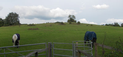
FACE IT has organised a number of walks around the public footpaths across the site to explain the extent of the proposed development and the impact it would have on the character of the landscape and the ecological damage it would do the Hart Valley. One such Walk Around Albany Farm took place in October 2013:
Planning History
Click here to view the Planning History for Watery Lane, including the SHLAA (strategic housing land availability assessment) entry
Appeal
You have probably heard the news that the planning application for Watery Lane was rejected by Hart’s planning committee. This scheme by Martin Grant would have seen over 300 houses, retail space and site for a doctor’s surgery built on low-lying land at Watery Lane, on the edge of Church Crookham. However, as expected, the applicant has appealed the decision. This means that the Planning Inspectorate will now determine whether Hart’s refusal should stand. The appeal is under Ref 14/00040/REFUSEon the Hart Planning website.
The Inquiry into the Appeal opened at 10.00 a.m. on 14th April 2015 and is currently taking place at The Lismoyne Hotel, 45 Church Road, Fleet, Hampshire, GU51 4NE Click here to read about the appeal. [/important]
How the appeal works
The first day (14th April) was for the registration of all interested parties and speakers. The inquiry is expected to last until Friday 24 April. Public speaking is being scheduled around the main presentations and witnesses and, at the discretion of the Inspector, the availability of those members of the public who have registered their interest in presenting their views .
The Hart council and the developer’s agents are presenting their cases both directly and through the use of expert witnesses.
It is important that we have a large number of interested residents attending, if only for a short period, on any of the week days following the 14th April. This will be our last opportunity to demonstrate the strong public concern against this development.
Associated documents can be viewed on the Hart Planning website ref:14/00504
FACE IT Position on Proposed Development on Land at Watery Lane
FACE IT opposes further large-scale development at Watery Lane and Albany Farm.
This greenfield site is designated as ‘not currently developable’ in the SHLAA and would require a change in planning policy by Hart to develop it.
Unsustainable
This is another unsustainable site isolated from facilities and with very limited public transport. The principle of tacking on small sites on greenfield land around the periphery of Fleet will result in dormitory enclaves of high-density housing remote from services and facilities with attendant social and sustainability issues caused by lack of access to community facilities due to distance and paucity of public transport. The proposed development at Watery Lane offers little or nothing by way of community facilities and has little to offer adjacent developments.
Ecology, Environment and Landscape Impact
The site includes part of the River Hart Valley which forms an important ecological corridor linking the Thames Basin Heaths Special Protection Area, the River Hart valley and the Basingstoke Canal. The site includes the River Hart itself which we feel should be protected and enhanced rather than built over. The route of the river is not made clear on the plan, in fact the watercourse is hardly shown on the plans at present (only in the southernmost part of the plan). There is no mention in the proposals of what will be done to protect, maintain and enhance this important landscape feature and its environs.
Part of the site adjoins the Basingstoke Canal Conservation Area and lies adjoining the Basingstoke Canal Site of Special Scientific Interest (SSSI), which is the canal itself. The site also adjoins ‘Redfields Rows’ which is a wooded area between the site and Redfields Lane which is believed to be ancient woodland and a Site of Interest for Nature Conservation (SINC), which may have sensitive ground flora that is susceptible to issues with direct access.
Eight species of bird featured on the UK BAP Priority list breed within or close to the site. These include lesser spotted woodpecker, marsh tit, spotted flycatcher, song thrush, bullfinch (only pair in the parish) and linnet. Further development would threaten these populations. Other rare species include 3 types of orchid, silver washed fritillary and white admiral butterflies, and pepper saxifrage in the meadowland . The surrounding woodlands are all highly sensitive ancient woodland with up to 18 indicator species. This valuable location enjoyed by so many local people would be lost should the proposed developments be allowed to go ahead.
Some areas designated as Sites of Alternative Natural Greenspace (SANGs) but it is unproven whether SANGs are effective in mitigating the effects of housing on disturbance into SPAs.
A detailed environmental assessments must precede any final consideration of this greenfield site for development.
High Water Table, Drainage Issues and Flood Risk
Watery Lane is aptly named due to its propensity to flooding (see Flood Risk). The high water table makes this site unsuitable for housing development. The River Hart itself runs through the development site and parts of the development encroach on the flood plain.
Run-off water from new development will presumably be fed into the River Hart, and into the adjacent stream that borders Watery Lane. This stream feeds into the River Hart and thence into the Loddon Catchment, not the Canal, and is the major drainage stream for the existing developments at Zebon Copse and adjacent industrial sites. This stream is already at capacity and flooding affects properties in Zebon Copse Estate, Zephon Common Lane and Crondall Road during times of peak flow. See report from Crookham Village Parish Council.
These existing drainage issues are already bound to be further exacerbated by the local QEB and Redfields redevelopments since both will significantly reduce natural soak-away areas and cause surge run-off water to enter the drainage system more quickly than at present. This will undoubtedly lead to more rapid accretion of run-off water into the system and the backing up of excess water into the drainage system in Zebon Copse (which has balancing tanks that drain into the stream).
Further runoff from new development at the proposed site would be unacceptable without very major works downstream or major additional pumping facilities.
Similar issues apply to the removal of foul water for which considerable pumping capacity would need to be added.
Further Issues With Transport Infrastructure and Traffic Flows
Lack of adequate roads is another reason why the area is most unsuitable for yet more development. Roads around western and southern Fleet are already at capacity and there is little scope for significant upgrades to existing routes. The site is over three miles from Fleet centre and the station, making walking and cycling unlikely, and there is poor public transport. Most transport movements from a development at Watery Lane would be by car.
The transport corridors suggested by Martin Grant Homes include Redfields Lane itself, Aldershot Road and Sandy Lane, which passes the new QEB development and is already subject to traffic calming, and the Basingstoke Canal, which has very limited capacity for cycle and pedestrian traffic. Development at QEB has yet to complete and this will further impact the already heavy traffic flow between the A287 and Reading Road South where long delays already occur daily during peak times.
The alternative route for traffic to the leisure centre, Calthorpe Park school or routes to the M3, A30 or Reading would be through the Zebon Copse estate (Brandon Road) itself a twisting road with existing traffic calming, or via the congested junction with Gally Hill Road, via the narrow Malthouse bridge at Crookham Village.
The Watery Lane / Albany Farm site would be accessed from Redfields Lane, which is already at capacity at peak times. The outline plans show a single entry and exit point at a new roundabout on Redfields Lane, which is bound to cause congestion in and out of the site at peak times, as well as disrupting existing traffic flows including those from the current new developments to the A287 and the adjacent St. Nicholas’s school and the recently expanded Redfields Garden Centre. The revised proposals for trffic-light controlled T-junction will do nothing to improve capacity and will disrupt traffic flow probably as much as the roundabout option.
The development of a new roundabout at the A287 junction with Redfields Lane may change travel patterns and introduce a new preferred traffic corridor into Fleet; this must be subject to a traffic assessment. As this is not a preferred site in the draft Local Plan it is unlikely to be included in the traffic modelling currently being undertaken to represent the preferred development sites and therefore we do not believe that the impact of this development and junction improvement can be accurately predicted.
Additional demand from commuters will exacerbate the traffic and parking problems at Fleet Station. The additional 150 parking spaces currently under construction will only partly address the existing demand.
Inadequate Provision for Schooling and Healthcare
The impact on 315 additional homes on schooling provision will be severe. The site is not within easy distance of a public primary school or secondary school.
There is no primary school within walking distance. The developers recognise this and originally included a site for a potential primary school, however this has now been removed, and even should a school be built, it would be a one-form entry which is unlikely to be adequate for the number of primary school children living on the development.
Secondary schooling is even more of a problem. As Courtmoor School in Fleet is already at capacity and cannot be expanded, the children of secondary school age will have to either travel across to Calthorpe Park school or travel out of the immediate area of Fleet to find schooling. It is unclear how the catchment areas for schools would be revised, as the expansion at Calthorpe Park is designed to cater for the existing housing expansions at QEB and Edenbrook, so children from the new estate may not receive priority and may have to travel out of area. If students are admitted, travel to Calthorpe Park school is likely to seriously affect local traffic as the ‘school run’ is likely to be through the Zebon Copse estate and across the canal at the narrow Malthouse Bridge.
See pre-application comments by Hampshire County Council (Education Officer) at http://publicaccess.hart.gov.uk/online-applications/applicationDetails.do?activeTab=consulteeComments&keyVal=MUCPOSHZ0BP00&consulteeCommentsPager.page=6
The plans now mention a site for a medical centre or GP surgery. This may assist with the issues of healthcare provision as it is already virtually impossible to get a same day doctor’s appointment and travel by car is necessary to reach local surgeries from Zebon Copse. A new local surgery may help alleviate this however it may also attract patients and traffic from a wider area. The addition of a new surgery would also affect the catchment area for the Crondall surgery and the existing Fleet surgeries.
High Density Housing and Parking Issues
315 dwellings within the proposed housing areas is high density housing which will be more dense that the existing housing (for example at Zebon Copse) yet is adjacent to open countryside. The outline plan from Martin Grant shows ‘focal squares’ on the main access route through the site. This type of design is due to the need to fit a large volume of houses in a small space i.e. high density housing (with little or no front gardens).
Experience from other sites shows that ‘focal squares’ very quickly become car parks and cause congestion.
The Martin Grant scheme includes the site of the current Albany Farm Livery Stables next to the Zebon Copse Centre currently used for stabling and an indoor riding school for the disabled https://www.facebook.com/pages/Albany-Farm-Livery-Stables/ which will almost certainly be redeveloped and lost (the pre-application proposes a bus/footway access through the site) and anyway the riding school could not continue without the paddock land for horses.
There are no business or employment opportunities shown at the site. This then continues Hart’s dependency on external employment opportunites and contributes to worsening commuting traffic flows.
Meadow View Cottage and Velmead Farm House, both listed Grade II, are adjacent to the development site and Poulters Bridge itself, also listed Grade II in 1986, is on the Basingstoke Canal adjacent to the Hillyburrow hill proposed as a SANG.
Summary
In summary this is yet another bolt-on development to Fleet in a site that is not a suitable location for large-scale housing development.
It is a greenfield site that forms part of the Hart Valley which an important ecological and landscape feature of the area and is an existing open space amenity for local people. Development here would be isolated from facilities and school provision, would do little for the local community, and will cause additional transport issues with a road system already overburdened with significant other local developments.
