LANDSCAPE CHARACTER SUMMARY OF THE KEY HART VALLEY SHLAA SITES
Grove Farm & Pilcot
There are three distinct compartments to the Grove Farm SHLAA site, two to the east of Hitches Lane and one to the west:
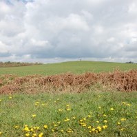
An extensive, open area of arable farmland north of Netherhouse Copse is dominated by a prominent and gently sloping hillock, a local landmark. The hillock, sometimes known as the ‘Tump‘ is particularly visible, being surrounded by well used public rights of way on three sides and Hitches Lane on the fourth. This hillock is of local importance as its landform has great natural beauty with gentle slopes in common with the subtle landform throughout the valley. The hillock, 13 metres above the floodplain, marks the eastern edge of the visual envelope of the River Hart Valley, at a point where it is 2kms wide and can be seen from Burnbrake Copse, Dogmersfield and Pilcot Road. The landform provides a very effective visual barrier between the attractive, rural and wildlife-rich River Hart Valley and urban Fleet. This noticeable feature also functions as a break in the development southward along Hitches lane and signals the beginning of the attractive rural landscape that is the setting for Crookham Village Conservation Area.
It forms a Local Gap controlling settlement coalescence between urban Fleet and the rural Crookham Village. The eastern boundary of this compartment marks the historic junction between the Thames Basin Heathlands (now urbanised and wooded) and the productive, accessible open farmland of the Hart Valley.
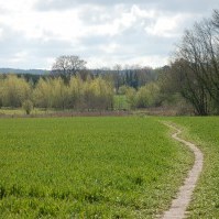
South of this open, arable compartment is a valuable, diverse and low lying vale occupied by ancient woodland, wet woodland, ancient hedgerow, meadows and a pond. The area is of great recreation, biodiversity and landscape value being highly accessible from the village and adjoining west Fleet, using a network of public and permissive footpaths. This high quality landscape has a high sensitivity to change. The ancient woodland SINC in particular is a fragile environment its important ground flora being especially vulnerable to increased use and trampling.
For more information see this page on Grove Farm.
This landholding is immediately south of the Crookham Village settlement boundary and, although it has been reduced in size as a SHLAA site, it has recently included all of Cross Farm fields and Zephon Common excluding the floodplain of the River Hart.
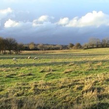
The fields and woods south of Crookham Village are of particularly high landscape, boidiversity and recreational value crossed by two popular footpaths that connect with Zephon Common and the Basingstoke Canal to the south and east. These footpaths offer excellent and panoramic views of the surrounding village and its countryside but also to distant landmarks such as Beacon Hill, Dogmersfield Park and the Horsedown Common on the Hart Downs. This gives the area a very special sense of place. In a generally more enclosed surrounding landscape this openness gives a real sense of being deep in the English countryside barely a mile from Fleet town centre. As such it is an invaluable resource for people from a wide local area and families often come on walks to enjoy the sight of grazing cattle and listen to the skylarks. Views of the village landscape are of high scenic quality as recognized in the Crookham Village and Basingstoke Canal Conservation Area documents.
Prominent historic buildings such as the Forge House, Brook House and Dogmersfield Church add to this picturesque scene. The landform here has great natural beauty, with gently sloping pasture sweeping down to the rushy meadows of the River Hart Valley and Brook Hill adds a further feature of interest with a clump of white poplar trees. Ancient woodland and common land occupy a wet low-lying vale below this grassy ridge and the mature woodland of the Basingstoke Canal SSSI forms a highly attractive eastern boundary.
This whole area is of exceptional local value being beautiful and wildlife rich, with impressive views of the village and its countryside setting. People from the surrounding urban areas can enjoy and be inspired by this local countryside easily reached by the excellent network of public footpaths.
Development within this outstanding and sensitive landscape would have significant detrimental impacts and damage an irreplaceable, accessible natural asset for the communities of Fleet and Crookham.
Watery Lane and Albany Farm
This landholding is immediately adjacent to the Zebon Copse development in Church Crookham. The SHLAA site includes part of the River Hart Valley which forms an important ecological corridor linking the Thames Basin Heaths Special Protection Area, the River Hart valley and the Basingstoke Canal.
Much of the land is low-lying and the River Hart runs directly through the site. The site includes paddocks, meadows, water-meadows and ancient woodland. A number of public footpaths run through the site and these are popular for walking. The paddocks support the stabling of horses which also support the Albany Stables which are used as a riding school.
Outside the SHLAA site boundary but immediately adjacent to the proposed development site and part of the proposed development scheme are the hill adjacent to the Basingstoke Canal at Poulters Bridge known as ‘Hillyburrow’. This hill has far-reaching views and can be easily reached from the Basingstoke Canal access at Poulter’s Bridge. Also adjacent to the development site are the Poulters Bridge water-meadows.
For more information see this page on Watery Lane.


